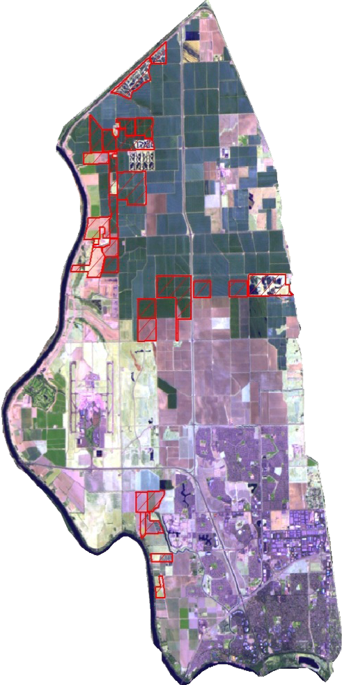
Annually, the Conservancy acquires LANDSAT satellite images of the Natomas Basin. The Conservancy works with Ducks Unlimited’s cartographic experts to acquire the desired LANDSAT image, refine it, and then overlay the Conservancy’s properties onto the image (see red cross-hatched portions of the Natomas Basin). Each year, the Conservancy reviews the many satellite images taken in the autumn of the prior year. Some images are more clear than others, and some, like the image here for 2010, is cloud free. In this case, the fly-over image taken on October 1, 2010 was the most useful to the Conservancy. The images help with tracking changes in Natomas Basin land use as well as in the Conservancy’s assemblage of mitigation land holdings.
New appointments to the Conservancy’s Board of Directors
Patrick Huber (left), Ethan Valburg (center), and Sean Minard (right) The Conservancy received three new appointments to the Conservancy’s Board of Directors. The City of Sacramento appointed Patrick Huber and Ethan Valburg. The County of Sutter appointed Sean Minard.

