
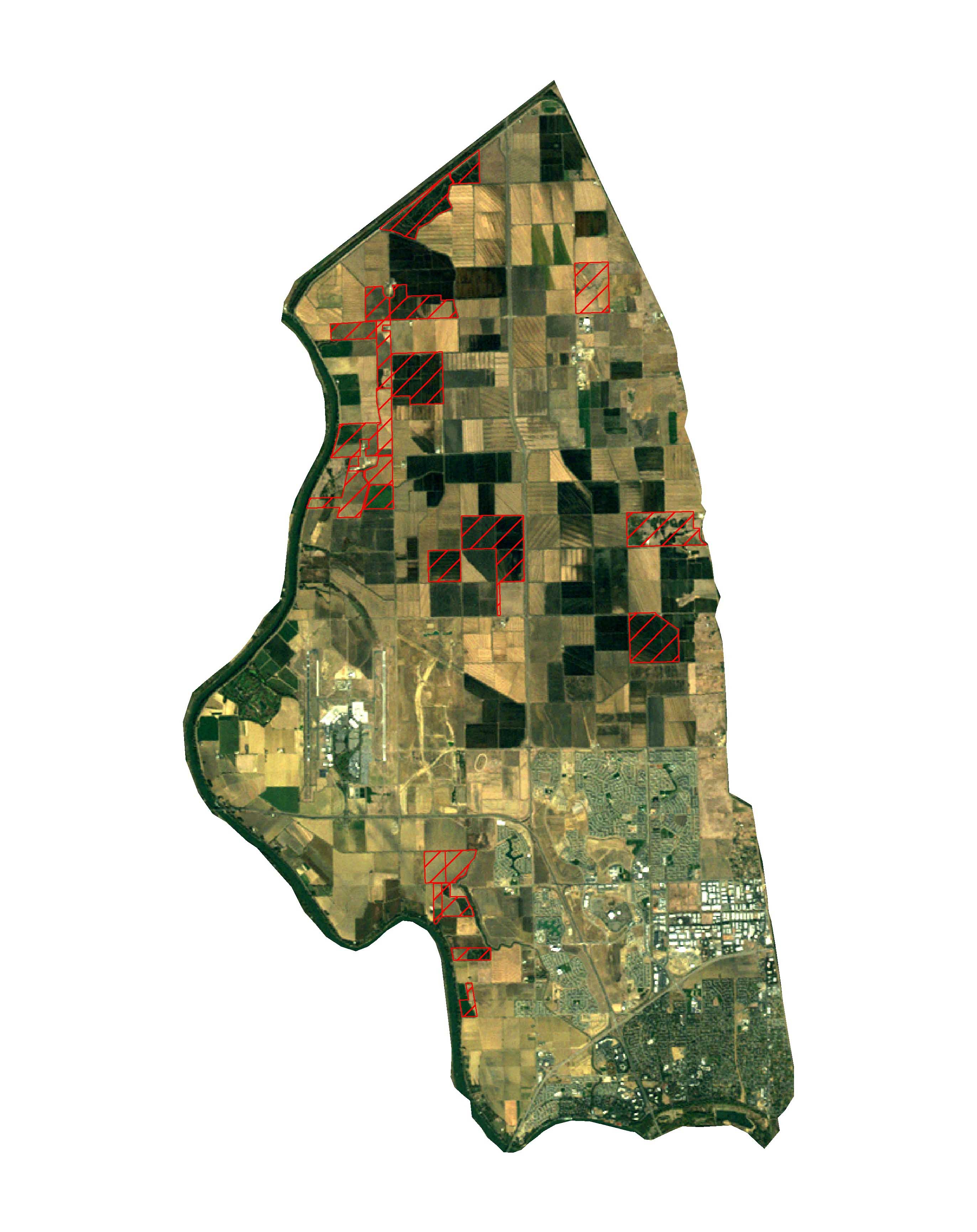
The satellite photo shown here reveals changes in the Natomas Basin since last year’s satellite photo. The Conservancy purchases these “bird in the sky” photos each year, overlaying on them the approximate boundaries of the Conservancy’s land holdings. This provides the Conservancy with an excellent historical record, year by year, of the sanctuaries it has acquired for the benefit of the covered species in the Natomas Basin Habitat Conservation Plan (NBHCP). Others are using them as well to track general growth and development in the Natomas Basin.
New appointments to the Conservancy’s Board of Directors
Patrick Huber (left), Ethan Valburg (center), and Sean Minard (right) The Conservancy received three new appointments to the Conservancy’s Board of Directors. The City of Sacramento appointed Patrick Huber and Ethan Valburg. The County of Sutter appointed Sean Minard.